
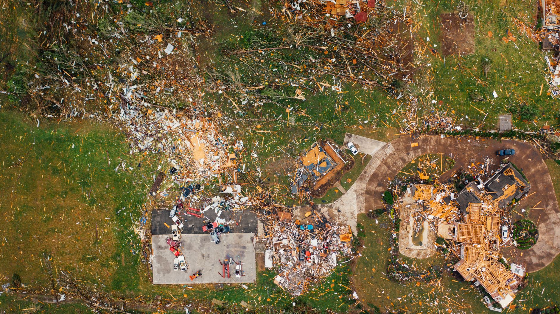
What Happens When Massive Hailstorms, 65 MPH Winds, and Tornado Warnings Strike at Once
When massive hailstorms, 65 mph winds, and tornado warnings threaten millions of Americans simultaneously, the danger is real, fast-moving, and potentially deadly. These multi-hazard severe weather outbreaks are among the most dangerous meteorological events that can sweep across the country, often affecting entire regions within hours. Understanding what drives these storms, what officials recommend, and how to protect yourself and your family can make the difference between safety and serious harm.
Table of Contents
- What Happens When Massive Hailstorms, 65 MPH Winds, and Tornado Warnings Strike at Once
- Understanding the Threat: How These Storms Develop
- What 65 MPH Winds Actually Do to Homes and Communities
- Massive Hailstorms: Understanding the Danger Beyond Property Damage
- Tornado Warnings vs. Watches: Knowing the Difference Could Save Your Life
- How to Prepare Before a Severe Weather Outbreak
- After the Storm: Staying Safe During Recovery
- Conclusion
- Frequently Asked Questions
- Key Takeaways
- Severe weather outbreaks can combine large hail, damaging straight-line winds exceeding 65 mph, and tornado threats simultaneously across millions of square miles.
- Tornado warnings mean a tornado has been detected or is imminent — take shelter immediately in an interior room on the lowest floor of a sturdy building.
- Hailstones can reach baseball size or larger during major outbreaks, causing serious injury and widespread property damage.
- Straight-line winds at 65 mph or higher can topple trees, down power lines, and damage structures just as seriously as a weak tornado.
- Staying informed through weather alerts and having a preparedness plan before storms arrive is the single most effective way to reduce risk.
Understanding the Threat: How These Storms Develop
Severe thunderstorm outbreaks capable of producing massive hail, destructive winds, and tornadoes typically form when warm, moist air from the Gulf of Mexico collides with cooler, drier air from the west or north. This clash creates atmospheric instability that fuels supercell thunderstorms — the most dangerous type of organized storm system. When conditions align, a single weather system can spawn multiple tornadoes while simultaneously producing giant hail and damaging wind gusts.
The atmospheric setup that drives these events is not unusual during spring and early summer across the central and southern United States, but similar outbreaks can strike the Southeast, Midwest, and even the Northeast at other times of year. That broad geographic reach is exactly why these events can threaten millions of Americans at once rather than a single community.
What 65 MPH Winds Actually Do to Homes and Communities
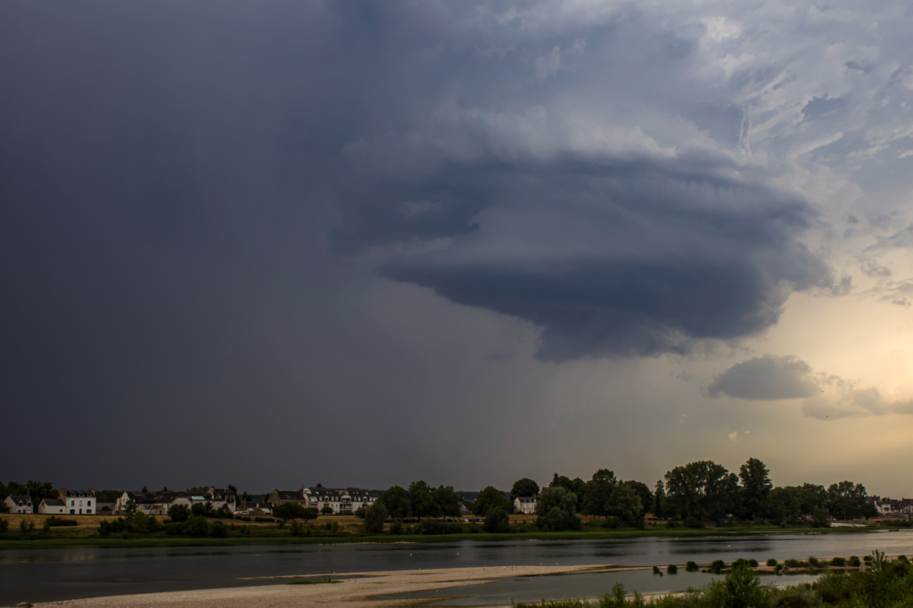
Straight-line winds at 65 mph are classified as damaging winds and can cause destruction comparable to a lower-category tornado. At this speed, large tree branches break, unsecured objects become dangerous projectiles, and older or poorly constructed buildings can suffer significant structural damage. Mobile homes and manufactured housing are especially vulnerable and should be evacuated when damaging wind warnings are issued.
Power outages are one of the most common and far-reaching consequences of high-wind events. Downed power lines create fire hazards and can remain energized even when they appear dead. Utility companies often need days or even weeks to restore power after a large-scale wind event, which can create secondary hazards including food spoilage, loss of medical equipment power, and carbon monoxide poisoning from improperly used generators.
Wind Damage: What to Watch For
- Downed power lines across roads and driveways — treat all downed lines as live and dangerous
- Structural roof damage, which may not be immediately visible from street level
- Broken windows from wind-driven debris
- Leaning or uprooted trees that may fall hours after the storm passes
- Flooded roadways caused by debris blocking storm drains
Massive Hailstorms: Understanding the Danger Beyond Property Damage
When massive hailstorms, 65 mph winds, and tornado warnings threaten millions of Americans in a single event, hail often gets underestimated compared to the tornado threat. This is a mistake. Large hail — stones an inch in diameter or larger — falls at speeds that can shatter vehicle windows, puncture roofing materials, and cause serious physical injury to anyone caught outdoors. Hailstones the size of golf balls or baseballs, which occur in major outbreaks, can be life-threatening if they strike a person directly.
Agricultural communities face enormous economic losses during major hail events, with crops sometimes destroyed in minutes. Beyond farms, hail damage to vehicles and residential roofing represents billions of dollars in insurance claims annually across the United States. After a severe hailstorm, homeowners should document all exterior damage with photographs before making temporary repairs, as this documentation is essential for insurance claims.
Hail Size Reference Guide
- Pea size (¼ inch): Minor damage possible, considered severe at ¾ inch and above
- Penny/Quarter size (¾–1 inch): Officially classified as severe hail; can damage vehicles and roofing
- Golf ball size (1¾ inches): Significant damage to property; dangerous to be outdoors
- Baseball size (2¾ inches): Extreme damage; life-threatening if struck directly

Tornado Warnings vs. Watches: Knowing the Difference Could Save Your Life
One of the most critical pieces of knowledge during any severe weather outbreak is understanding the difference between a tornado watch and a tornado warning. A tornado watch means conditions are favorable for tornado development in your area — you should stay alert, monitor weather updates, and be ready to act. A tornado warning means a tornado has either been spotted visually or detected on radar and is imminent or already occurring.
When a tornado warning is issued for your location, you should stop what you are doing immediately and move to your designated shelter location without delay. Every minute counts when a tornado is approaching. Do not wait to see the storm before taking shelter, as many tornadoes are obscured by rain or darkness.
Where to Shelter During a Tornado Warning
- Move to an interior room on the lowest floor of a permanent structure — avoid windows at all costs
- Bathrooms, closets, and hallways away from exterior walls offer the best protection in most homes
- If you are in a mobile home, leave immediately and go to a nearby sturdy building or designated shelter
- If caught outdoors with no shelter available, lie flat in a low-lying ditch and cover your head with your hands
- Never shelter under a highway overpass — wind speeds increase through these structures and offer no protection
How to Prepare Before a Severe Weather Outbreak
Preparation done well before storms arrive is far more effective than reacting in the moment. Building a household emergency plan, assembling a storm kit, and knowing your community’s warning systems are all steps that take very little time but pay enormous dividends when severe weather threatens. Local emergency management agencies regularly publish guidance on shelter locations, alert systems, and evacuation routes, and this information should be reviewed annually.
A basic storm emergency kit should include enough water and non-perishable food for at least 72 hours, a battery-powered or hand-crank weather radio, a first aid kit, flashlights with extra batteries, important documents in a waterproof container, and any necessary medications. Keep this kit in an accessible location near your shelter area so you do not have to search for it under stress.
Sign up for your county or municipality’s wireless emergency alert system and ensure your phone’s emergency alerts are enabled. These systems can push tornado warnings and severe thunderstorm warnings directly to your device even without a specific app. Weather radio remains the most reliable alert system during power outages when cellular networks may be overloaded or offline.

After the Storm: Staying Safe During Recovery
The danger from a severe weather outbreak does not end when the last storm cell moves through. Post-storm hazards claim lives every year and deserve the same respect as the storms themselves. Downed power lines, structurally compromised buildings, flooded roads, and gas leaks are all serious threats that persist long after the wind and hail stop.
Wait for official clearance before returning to evacuated areas, and never drive through floodwaters — even a few inches of moving water can sweep a vehicle off the road. If you smell gas inside your home after a storm, leave immediately, do not operate any switches, and call your gas utility from a safe distance. Communities with high rates of pre-existing economic vulnerability may face longer recovery timelines; local relief organizations and government assistance programs are important resources in the aftermath of major events.
For a broader look at how weather and other environmental stressors intersect with community resilience, it is worth understanding underlying social factors. For example, examining which Louisiana cities face the highest poverty rates or reviewing poverty challenges in Connecticut communities helps illustrate why some populations face greater barriers to storm recovery than others.
Frequently Asked Questions
What is the difference between a tornado watch and a tornado warning?
A tornado watch means atmospheric conditions are favorable for tornado development and you should remain alert and prepared. A tornado warning means a tornado has been confirmed by radar or a trained spotter and is imminent or occurring — you should take shelter immediately. Warnings require immediate action, not continued monitoring.
How large does hail need to be to cause serious damage?
Hail is officially classified as severe when it reaches ¾ of an inch in diameter, roughly the size of a penny. At this size and larger, hail can damage vehicle paint, crack windshields, and puncture roofing. Hail at golf ball size or larger poses a direct physical threat to anyone outdoors and can cause catastrophic property damage.
Can straight-line winds at 65 mph be as dangerous as a tornado?
Yes, straight-line winds at 65 mph can cause damage comparable to a weak tornado and should be taken very seriously. These winds can topple trees, destroy unsecured structures, and turn loose objects into dangerous projectiles. Mobile homes and older buildings are particularly vulnerable to wind damage at these speeds.
What should I do if a tornado warning is issued while I am driving?
If a tornado warning is issued while driving, you should not try to outrun the tornado in your vehicle. Instead, seek shelter in a sturdy nearby building immediately. If no building is available, abandon your vehicle and lie flat in a low ditch away from trees and cars, covering your head with your hands.
How do I sign up to receive tornado and severe weather alerts on my phone?
Most smartphones receive Wireless Emergency Alerts (WEA) automatically from federal and local agencies as long as the feature is enabled in your settings. You can also download your local National Weather Service app or county emergency management app for additional alerts. A battery-powered weather radio is recommended as a backup during power outages.
Conclusion
When massive hailstorms, 65 mph winds, and tornado warnings threaten millions of Americans, the compounding nature of these hazards demands a serious, informed response. No single element of a severe weather outbreak should be dismissed — hail, wind, and tornadoes each carry the potential for catastrophic harm to people and property. The most effective protection is always preparation: know your local alert systems, have a shelter plan in place, keep an emergency kit ready, and stay informed from the moment a watch is issued. Severe weather is an enduring part of life across much of the United States, but the risks it presents can be significantly reduced with awareness, planning, and swift action when warnings are issued.