What Is the Highest Point in Utah?
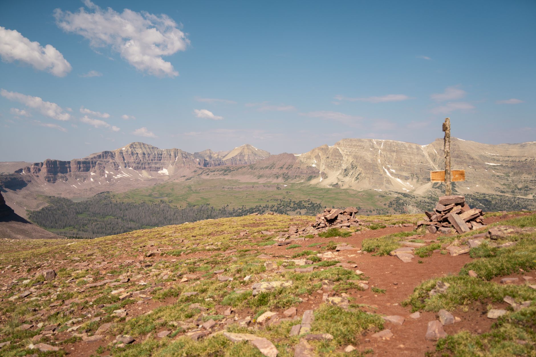
Revealing the highest point in Utah and why it’s worth the visit starts with one name: Kings Peak. Rising to 13,528 feet above sea level, Kings Peak is located in the High Uintas Wilderness within the Uinta-Wasatch-Cache National Forest in northeastern Utah. It is the tallest summit not only in Utah but also the highest peak in the entire Uinta Mountain Range.
Table of Contents
- What Is the Highest Point in Utah?
- Key Takeaways
- Why Kings Peak Is Worth the Visit
- How to Get to Kings Peak: Routes and Trailheads
- Best Time to Visit Kings Peak
- Essential Gear and Preparation Tips
- Who Should Attempt Kings Peak?
- Camping Along the Henry's Fork Route
- Conclusion
- Frequently Asked Questions
For hikers, mountaineers, and nature lovers, Kings Peak offers a rare combination of alpine scenery, solitude, and a genuine sense of accomplishment. The route is demanding but accessible to well-prepared hikers, making it one of the most rewarding outdoor goals in the American West.
- Elevation: 13,528 feet above sea level
- Location: High Uintas Wilderness, Duchesne County, Utah
- Most popular trailhead: Henry’s Fork Trailhead
- Round-trip distance: Approximately 28–30 miles from Henry’s Fork
- Best season to visit: Late June through September
Key Takeaways
- Kings Peak at 13,528 feet is officially Utah’s highest point and a celebrated backcountry destination.
- The Henry’s Fork Trail is the most commonly used route, typically completed as a two- to three-day backpacking trip.
- Proper acclimatization, gear, and navigation skills are essential for a safe summit attempt.
- Wildlife, wildflowers, and pristine alpine lakes make the journey as rewarding as reaching the top.
- No technical climbing equipment is required, but physical fitness and preparation are non-negotiable.
Why Kings Peak Is Worth the Visit
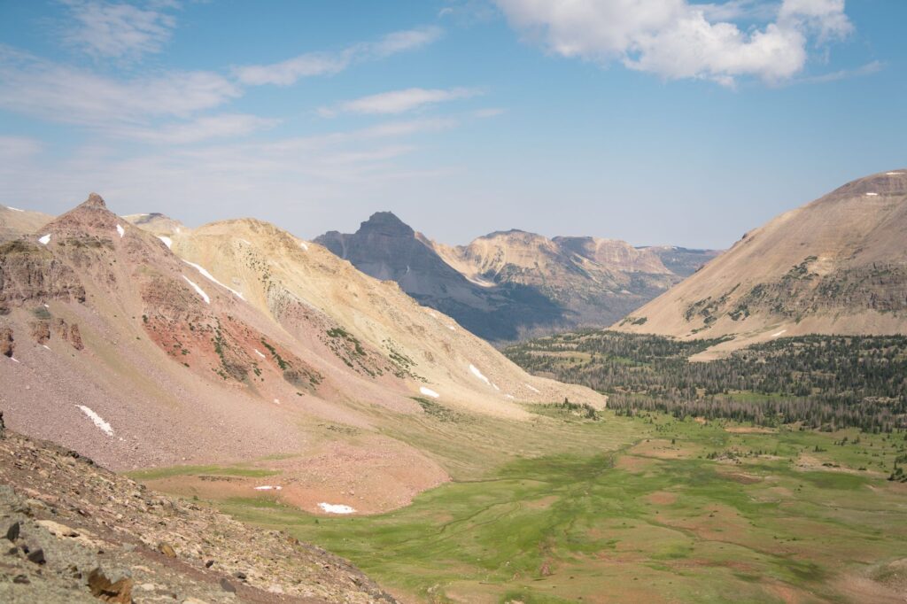
Revealing the highest point in Utah and why it’s worth the visit goes far beyond the bragging rights of standing on a state high point. The journey to Kings Peak takes you through some of the most unspoiled wilderness in the continental United States. The High Uintas Wilderness spans over 460,000 acres of roadless terrain, filled with glacially carved lakes, meadows carpeted in wildflowers, and dramatic ridgelines.
Unlike many popular national park destinations, the route to Kings Peak sees far fewer crowds, giving hikers a genuine sense of exploration. Mornings on the summit deliver panoramic views stretching across Wyoming and deep into the heart of Utah — on a clear day, the horizon seems endless.
Wildlife and Natural Beauty Along the Way
The High Uintas Wilderness is home to moose, black bear, mule deer, and a variety of bird species including raptors that ride thermals above the ridgeline. Streams along the trail support healthy populations of cutthroat trout, making the area popular with backpackers who also enjoy fishing.
Wildflower meadows typically peak in late July and early August, transforming the landscape into a vivid tapestry of color just below the timberline. Even if you never reach the summit, the scenery along the trail alone justifies the effort.
How to Get to Kings Peak: Routes and Trailheads
The most popular starting point is the Henry’s Fork Trailhead, located near Mountain View, Wyoming, just north of the Utah border. Despite its Wyoming address, this trailhead provides the most direct and well-marked path into Utah’s backcountry toward Kings Peak.
A second option is the Uinta River Trailhead, accessed from the southern slope near the town of Roosevelt, Utah. This route is longer and less traveled but offers a different perspective on the wilderness. Most first-time visitors prefer the Henry’s Fork approach for its clear trail markings and established camping areas.
Trail Distances and Elevation Gain
- Henry’s Fork route round-trip: Approximately 28–30 miles
- Total elevation gain: Roughly 4,000–4,500 feet depending on camp location
- Uinta River route round-trip: Approximately 35–40 miles
- Average completion time: 2–3 days for most hikers
Best Time to Visit Kings Peak
The hiking window for Kings Peak is relatively narrow. Late June through early September represents the safest and most accessible window, with snow typically clearing the upper ridges by late June in most years. Attempting the summit earlier in the season requires experience with snow travel and appropriate gear such as microspikes or an ice axe.
July and August offer the most reliable weather, though afternoon thunderstorms are common in the mountains throughout summer. Starting early in the morning — ideally before dawn on summit day — allows hikers to descend below the exposed ridgeline before storms develop. September brings crisp air and golden aspen foliage, but early snowfall becomes a real possibility after mid-month.
Essential Gear and Preparation Tips
Kings Peak is a serious backcountry objective. While no technical climbing skills are required, the terrain above timberline is rocky and exposed, and altitude can affect even fit hikers who are not acclimatized. Spending the first night at a camp around 10,000–11,000 feet before pushing for the summit the following morning is strongly recommended.
What to Pack
- Layered clothing including a waterproof shell and insulated mid-layer
- Navigation tools: topographic map and compass (cell service is unreliable)
- Headlamp with extra batteries for pre-dawn starts
- High-calorie food and at least two to three liters of water capacity per person
- A water filter or purification tablets — streams are plentiful but should be treated
- First aid kit including blister treatment and medications for altitude symptoms
- Bear canister or hang system for food storage
- Trekking poles for stability on rocky terrain
Permits and Regulations
As of current regulations, no permit is required to hike into the High Uintas Wilderness for day use or overnight backpacking. However, Leave No Trace principles are enforced, and campfires are restricted or prohibited in certain high-elevation zones. Always check with the Uinta-Wasatch-Cache National Forest before your trip for the most current fire restrictions and any updated access information.
Who Should Attempt Kings Peak?
Kings Peak is best suited for hikers with solid backpacking experience and good cardiovascular fitness. The distance and elevation gain over multiple days require endurance rather than technical skill. Beginners who are enthusiastic but new to multi-day backpacking should consider building experience on shorter overnight trips first.
Families with older children who have camping experience can successfully complete the trip, though the summit push involves a rocky scramble above Anderson Pass that may not be appropriate for young or hesitant hikers. There is no shame in making Anderson Pass your turnaround point — at over 12,700 feet, the views from there are extraordinary in their own right.
If you enjoy exploring facts about geography and regional highlights, you might also find it interesting to read about New Mexico’s regional trends and what makes different counties stand out, or explore unique geographic and demographic insights from Maryland counties as part of a broader interest in American regional character.
Camping Along the Henry’s Fork Route
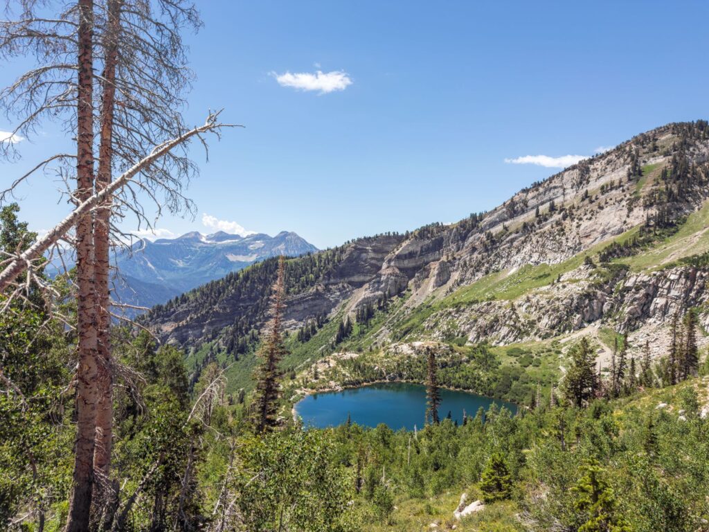
The most popular camping areas along the Henry’s Fork route include Elkhorn Crossing, the meadows around Henry’s Fork Lake, and areas near Dollar Lake. Henry’s Fork Lake at roughly 10,600 feet is a particularly scenic basecamp for summit day, with calm water reflecting the peaks above and excellent fishing during summer months.
Camp at least 200 feet from water sources, trails, and other campers to minimize environmental impact. Choose established sites where possible to avoid expanding vegetation damage in this sensitive alpine ecosystem.
Frequently Asked Questions
How hard is it to hike Kings Peak in Utah?
Kings Peak is considered a strenuous but non-technical hike. The round-trip distance of roughly 28–30 miles from Henry's Fork Trailhead and over 4,000 feet of elevation gain make it challenging. Hikers should have solid cardiovascular fitness and prior backpacking experience before attempting it.
What is the best time of year to climb Kings Peak?
Late June through early September is the best window, with July and August offering the most reliable snow-free conditions. Afternoon thunderstorms are common in summer, so plan to reach the summit before noon. Snow can return to the high ridges by mid-September.
Do you need a permit to hike Kings Peak?
No permit is currently required for hiking or overnight backpacking in the High Uintas Wilderness. However, Leave No Trace principles apply, and campfire restrictions are enforced in many high-elevation areas. Check with the Uinta-Wasatch-Cache National Forest for current regulations before your trip.
How long does it take to hike Kings Peak?
Most hikers complete the trip in two to three days. The first day typically covers the approach to a basecamp near Henry's Fork Lake, summit day is day two, and day three is the return hike to the trailhead. Highly fit hikers occasionally complete it in a single long day, but this is not recommended for most people.
Is Kings Peak the highest point in the Rocky Mountains?
No, Kings Peak is the highest point in Utah and the tallest summit in the Uinta Range, but it is not the highest point in the Rocky Mountains. Colorado's Mount Elbert holds that distinction at 14,440 feet. Kings Peak is, however, one of the prominent state high points in the western United States.
Conclusion
Revealing the highest point in Utah and why it’s worth the visit ultimately comes down to what Kings Peak represents: a genuine wilderness adventure through one of the most beautiful and underrated mountain ranges in the United States. At 13,528 feet, this summit rewards those who put in the preparation with stunning views, pristine alpine environments, and a lasting sense of achievement.
Whether you are chasing state high points, seeking a multi-day backpacking challenge, or simply looking for a profound connection with the natural world, Kings Peak delivers on every level. Plan carefully, respect the wilderness, start your summit day early, and you will understand exactly why this peak deserves a place on every serious hiker’s bucket list.